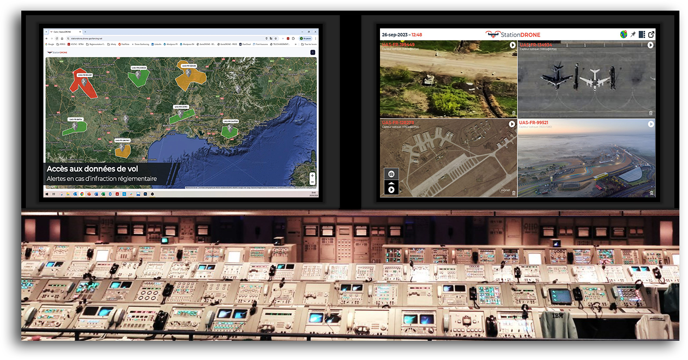
Map data comes into play before (flight planning), during (geolocation, coactivity, insertion in air traffic, etc.) and after the flight (logbook, data processing, GDPR, etc.).
Even if geolocation is a major issue for the safety of people in order to perfectly manage the sharing of airspace with civil AND military aviation (remember HERE that the flight authorizations requested on Alpha-Tango and / or the CTR are granted in fact by the Ministry of the Armed Forces and the Prefectures), it is also an essential element for the use of the data collected by the sensors installed on the drones (optical, thermal, multispectral camera, etc.).
Flight security
Before the “massive” arrival of drones on the market, the role of air traffic control was to monitor approximately 800 aircraft in real time in order to prevent any collisions. However, the arrival of drones has turned this organization upside down. Remember that the collision of a drone with an aircraft (airliner and / or fighter) may be sufficient to cause an air crash.
In the absence of a responsible practice by professional and / or leisure telepilots (as was the case in aeromodelling clubs because beginners are surrounded by experienced people), the DGAC had to implement a regulation binding on this subject focusing on 3 axes :
- The registration of the aircraft (it depends on its size) in order to be able to easily identify the owner (the identification number of the drone must be affixed to the drone). More informations are available in one of our previous posts (drone certification).
- Obtaining a flight authorization. Except in the event of visual theft in an authorized unpopulated area (cf. Geoportail site allowing the identification of authorized and / or permanently prohibited flying areas AND consultation of NOTAMs for temporary prohibitions), the operator must contact the authorities (responsible for CTR, prefecture, ministry of the armed forces) a flight authorization. This request must include a map defining the flight plan and the operational scenario envisaged. More informations are available in one of our previous posts (which regulation to respect).
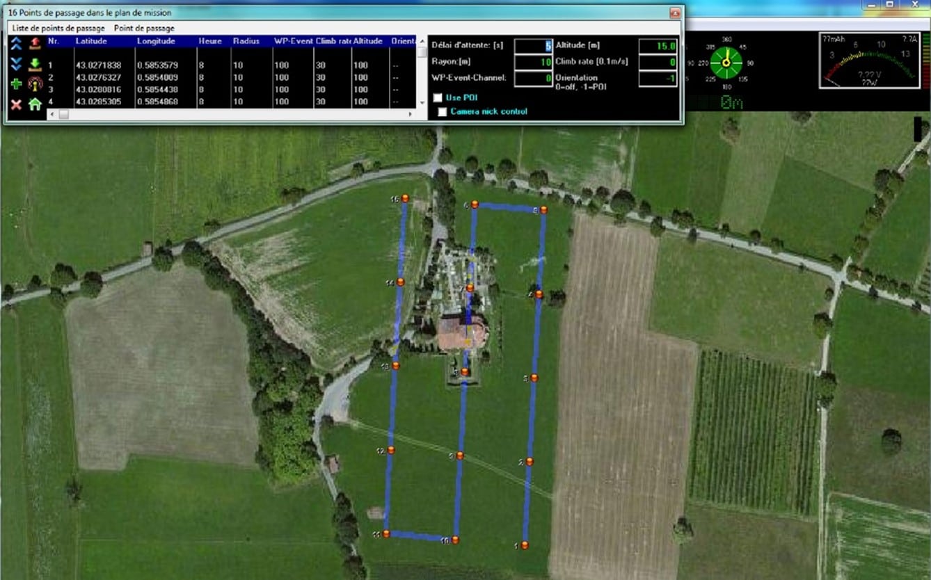
- The implementation of digital reporting systems to e-locate the drone in real time during flight. Since 2020, all aircraft are required to be equipped with a digital signaling device (radio system transmitting in real time the identification number of the drone, its spatial location, speed and route). This data is collected near sensitive sites to distinguish threats (malicious drones) from drones flying nearby. In addition, several R&D projects are in progress in order to exploit this data: (i) Coactivity (the objective here is to avoid collisions when several drones are moving close to each other), (ii) Geofencing (taking control of the drone when it deviates from its flight path and / or its flight perimeter using systems independent of the vector flight control card.
The use of data collected from the sensors
Aerial shot data (optical, thermal, multispectral, etc.) are currently used to meet specific specific needs.
The storage of raw data from the sensors in order to supplement Geographic Information Systems (GIS) is of no interest, however, if the shots are not time-stamped and geolocated frame by frame.
The search engines available on the market are often inefficient in the absence of this information, subsequent exploitation will be very difficult (an operator will not go through 30 minutes of video to find a specific location).
In addition, the storage of this information can present risks, the operator not being able to guarantee that the stored data does not contain any overflight shot of a private property that has not obtained the agreement of the owner, which would violate the GDPR regulations (protection of personal data).
Conclusion
Mapping is a key element for the optimal use of drones.
Whether before (flight planning), during (management of coactivity) or after the flight (storage of flight logs and geolocated and time-stamped shots), the DroneCARE software will allow you to better manage this entire process. Don’t hesitate to contact us to get more informations about our software solution for drone activities management.