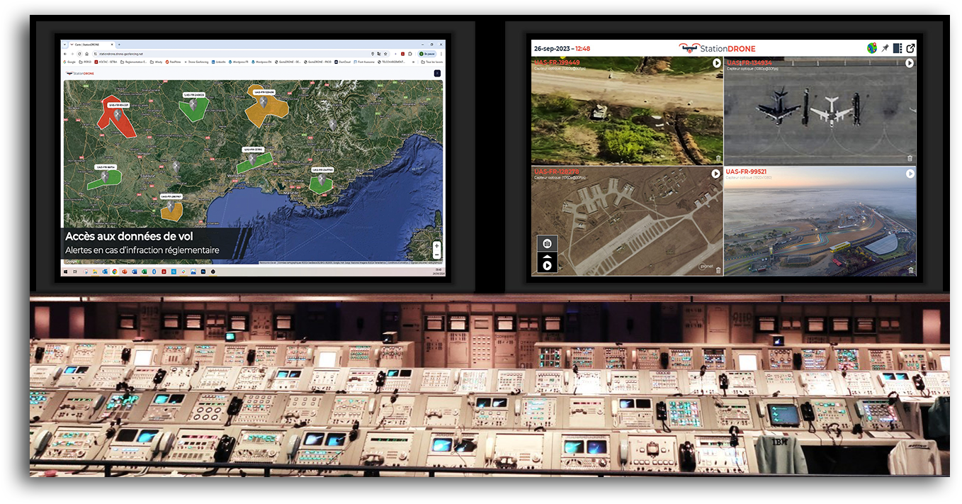
Skip to content
Drone Geofencing
Professional drone management software
Drone GeofencingDrone Geofencing
  • Home
  • About
  • GestaDRONE
    • Operator
    • Remote pilot
    • Material
    • Flight request
    • Artificial Intelligence
  • Our Offers
    • GestaDrone
    • Storage
  • Communication
    • Blog
    • Press Relations
  • Contact
    • Contact us
    • Become a distributor
  • Home
  • About
  • GestaDRONE
    • Operator
    • Remote pilot
    • Material
    • Flight request
    • Artificial Intelligence
  • Our Offers
    • GestaDrone
    • Storage
  • Communication
    • Blog
    • Press Relations
  • Contact
    • Contact us
    • Become a distributor

Daily Archives: September 28, 2020

You are here:
  1. Home
  2. 2020
  3. September
  4. 28

Map data in the field of drones, where do they involve ?

Not classifiedBy Samuel BrauSeptember 28, 2020

Map data comes into play before (flight planning), during (geolocation, coactivity, insertion in air traffic, etc.) and after the flight (logbook, data processing, GDPR, etc.). Even if geolocation is a major issue for the safety of people in order to perfectly manage the sharing of airspace with civil AND military aviation (remember HERE that the

Drone Geofencing
Conception by Drone Geofencing
  • Legal notice
  • Sitemap
  • LinkedIn
  • Google My Business
Footer
Go to Top